
Technology advancements have allowed engineering with drones to integrate into industries for their versatility and ability to reach places that humans normally could not. In the field, drones or Unmanned Aerial Vehicles (UAVs), allow for efficient surveying and accurate 3D modeling thanks to the 4K UHD camera mounted on the base of the device.
What are we using?
Hedgehog uses the DJI Phantom Pro quadcopter with a 4K UHD video camera. The 3-axis gimbal provides improved stability by counter-balancing against wind turbulence and maintains the horizon level during changes in flight direction.
3D modeling of a solar array
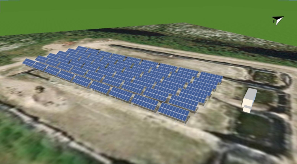
(Photo: 3D model of a solar array)
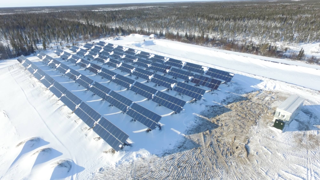
(Photo: actual solar array)
In the far north of Ontario, our team surveyed a solar array to determine the position of an e-house which was in transit. The DJI Phantom Pro captured accurate measurements of the solar farm through the use of photography on various heights and angles. The critical data points allowed our team to generate a precise 3D model of the site in order to determine the best placement for the unit.
Traditionally, a human surveyor would be required to physically access the site in order to take measurements. In some circumstances, this increases the likelihood of injury or harm to the person while taking more time to complete the task than a human remotely piloting a UAV.
Aerial land surveying using drones
(Photo: an aerial survey with a drone)
Drones can reach hazardous terrain or areas that are generally less accessible to humans. In the case of a remote island community in British Columbia, our DJI Phantom Pro compiled accurate topographical data of the island within a short time-frame. Observing the land from a 360-degree panoramic view supported our project managers in logistics planning.
Using the 4K UHD camera placed on the bottom of the drone, we photographed the terrain from different heights and angles to create a visual representation of the site with geotagged location points on each image. This real-time data was analyzed to support decision-making.
What are the Canadian drone regulations?
The Canadian Aviation Regulations (CARs) outline that drone pilots are required to carry a valid drone pilot certificate and only fly ones that are marked and certified. Transport Canada offers the following safety regulations when piloting:
- Drones should fly below 122 meters (400 feet) in the air
- Fly at a minimum horizontal distance of 30 meters from bystanders (for basic operations)
- Avoid interfering with emergency operations and advertised events
- Must remain at least 5.6 kilometers from airports
- Use an outside controlled airspace (for basic operations)
Hedgehog abides by these guidelines for every project to ensure the safety of our team, clients, and the public. To learn more about the Canadian drone regulations visit the Transport Canada website.
New heights of efficiency
Drones are becoming an integral part of engineering for their ability to enhance surveying capabilities while maintaining an acceptable level of safety for operators.
The high-cost for buying a UAV is a barrier to entry but the ROI comes in the form of time savings, safety, and increased operational efficiency that minimizes constraint on the budget. This is a major reason why more engineers and project managers are turning to UAV technology.
Hedgehog will continue to test new methods for engineering with drones while providing expert surveying and 3D modeling solutions for our clients.
Don’t forget to follow us on Twitter and LinkedIn for updates!
 Founder Michael Wrinch Keynotes Decarbonizing Remote Communities Virtual SummitApril 15, 2024 - 9:00 am
 Hedgehog Tech Named Finalist for Reuters Global Energy Transition AwardsMarch 14, 2024 - 10:46 am
 Hedgehog Tech Presenting at AIMS SafeConnect 2024February 22, 2024 - 12:04 pm
 Hedgehog Tech Founder Michael Wrinch Appears on the SDG in Action PodcastJanuary 29, 2024 - 1:15 pm
 Hedgehog Tech Media Roundup: January 2024January 22, 2024 - 8:18 am


